


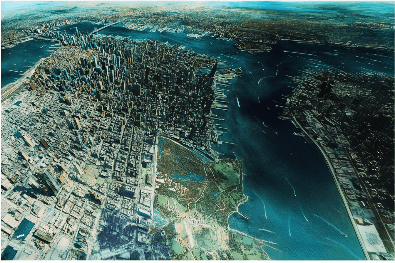
Geospatial data analytics is the process of analyzing location-based data to uncover patterns, trends, and insights. It enables businesses, governments, and researchers to make informed decisions based on geographic and spatial relationships. From urban planning to disaster management, geospatial analysis is transforming industries worldwide.
This guide explores what geospatial analytics is, its importance, different analysis methods, use cases, and how Geoapify's tools can help organizations leverage location intelligence.
What is Geospatial Analytics?
Geospatial data analysis is the process of interpreting location-based data to uncover patterns, relationships, and trends. It integrates geographic coordinates with descriptive and temporal data, enabling industries like urban planning, logistics, and environmental science to make data-driven decisions. By answering "where" questions—where events occur, where resources are needed, and how locations change over time—geospatial analysis transforms raw data into actionable insights.
Modern geospatial analysis relies on powerful technologies such as Geographic Information Systems (GIS), remote sensing, and real-time GPS tracking. Visualization techniques like interactive maps, heatmaps, and spatial clustering allow businesses and researchers to analyze location intelligence effectively. Tools like Geoapify’s APIs simplify access to geospatial data, offering solutions for geocoding, routing, isochrones, and place search, making it easy to integrate spatial analytics into applications.
With the rise of big data and AI, geospatial analysis is more accessible than ever. Businesses can optimize supply chains, cities can improve traffic flow, and environmental organizations can monitor climate change—all through the power of location intelligence. Whether using Geoapify’s APIs for real-time location insights or mapping global trends, geospatial data is shaping the future of decision-making.
Benefits of Geospatial Data Analysis
Geospatial data analysis offers numerous advantages across various industries by providing location-based insights that enhance decision-making, efficiency, and innovation. Below are the key benefits:
1. Improved Decision-Making
- Helps businesses, governments, and organizations make data-driven choices based on spatial insights.
- Enhances urban planning, resource management, and infrastructure development.
- Supports risk assessment and disaster preparedness by analyzing geographic patterns.
2. Cost Savings and Operational Efficiency
- Optimizes supply chains, logistics, and transportation routes, reducing fuel consumption and delivery times.
- Assists in selecting optimal retail locations based on demographic and foot traffic data.
- Improves asset tracking and field service management through real-time geospatial data.
3. Enhanced Customer Insights and Market Analysis
- Enables targeted marketing and location-based advertising.
- Analyzes consumer behavior and preferences using geospatial trends.
- Supports business expansion strategies by identifying high-potential areas.
4. Environmental and Disaster Management
- Assists in tracking climate change, deforestation, and land-use changes.
- Improves early warning systems for natural disasters like floods, wildfires, and earthquakes.
- Enhances emergency response planning by identifying high-risk zones.
5. Smart Cities and Public Safety
- Helps manage urban traffic congestion and optimize public transportation systems.
- Supports crime mapping and predictive policing for better law enforcement strategies.
- Enhances infrastructure planning, including waste management and energy distribution.
6. Easy Integration with Geospatial APIs
- Modern geospatial APIs, such as Geoapify’s Geocoding, Routing, and Isochrone APIs, provide seamless access to spatial data.
- Businesses and developers can integrate location intelligence into applications without needing complex GIS expertise.
- Real-time geospatial analytics improves decision-making in navigation, logistics, and customer experience.
To explore more about the significance of geospatial technologies, check out our detailed guide: Why GIS is Important?.
By leveraging geospatial data, organizations can gain a competitive edge, reduce risks, and improve efficiency, making it a powerful tool for various industries.
Examples and Use Cases of Geospatial Data Analysis
Geospatial data analysis is transforming industries by offering precise location-based insights that drive smarter decisions. From urban planning to logistics and marketing, businesses and organizations are leveraging spatial intelligence to optimize operations, improve efficiency, and enhance customer experiences. Below are key industry applications and practical use cases where geospatial technology plays a critical role.
Real Estate
Geospatial analysis enhances real estate platforms by integrating interactive maps for rental and property searches. Investors and buyers can analyze neighborhood trends, infrastructure, and accessibility to make informed property decisions. Additionally, spatial data helps in property valuation, assessing proximity to public transport, schools, and essential services. More details are available here.
Smart Cities
Cities use geospatial technology to optimize urban planning, traffic flow, and infrastructure development. Spatial insights improve public transport efficiency, waste management, and energy distribution, making cities more sustainable and livable. Governments and planners rely on real-time geospatial data to enhance decision-making and address challenges like congestion and resource allocation. Read more about smart city applications here.
Logistics & Delivery
Geospatial data enables route optimization, fleet tracking, and real-time delivery management, helping businesses reduce operational costs and improve efficiency. Companies use location intelligence to streamline last-mile deliveries, optimize warehouse locations, and enhance supply chain logistics. This improves delivery times and customer satisfaction. Explore more on logistics solutions here.


Interactive Real Estate Maps for Property Listings


Mapping Solutions For Smart Cities and Urban Planning


Logistics APIs | Delivery & Tracking Solutions
Travel & Tourism
Tourism businesses use geospatial insights to offer personalized travel recommendations, optimize visitor experiences, and analyze movement patterns. Interactive travel maps and real-time geolocation services help travelers explore destinations efficiently. Tour operators also benefit from spatial analysis for marketing campaigns and infrastructure planning. Learn more about travel and tourism applications here.
Healthcare & Social Assistance
Geospatial analysis improves healthcare accessibility by identifying optimal locations for hospitals, clinics, and emergency services. It also plays a crucial role in epidemic tracking, resource distribution, and emergency response route optimization. Real-time location data enhances public health planning and crisis management. Read more on geospatial applications in healthcare here.
Education
Schools and universities use location intelligence to analyze student distribution, optimize school bus routes, and plan new educational facilities. Geospatial insights help in district zoning, campus safety analysis, and accessibility planning, ensuring better decision-making for education institutions. Explore more about education-focused geospatial solutions here.


Geospatial Solutions for Travel & Tourism industry


GIS in Healthcare - Public Health Location Intelligence and Mapping Solutions


Maps and GIS for Education
Route Optimization
Businesses and logistics providers use geospatial analysis to minimize travel time and fuel costs. Multi-stop route planning improves delivery efficiency, emergency response times, and field service operations. Discover more on route optimization here.
Travel Time Maps
Travel time analysis allows businesses to map customer accessibility, optimize real estate searches based on commute times, and enhance event planning by analyzing attendee reachability. Learn more about travel time maps here.
Address Lookup
Accurate address validation and location search are essential for e-commerce, logistics, and customer onboarding. Geospatial tools help auto-fill addresses in online forms, reduce failed deliveries, and improve operational efficiency. More details on address lookup are available here.
EV Routing
Electric vehicle routing ensures optimal navigation based on charging station locations, reducing range anxiety for drivers. Fleet operators use geospatial insights to plan efficient EV routes and manage charging infrastructure effectively. Read about EV routing solutions here.
Geotargeting in Marketing
Businesses leverage geospatial insights to target customers based on location and movement patterns. Location-based advertising, foot traffic analysis, and proximity marketing help brands reach their audience effectively. Learn more about geotargeting strategies here.


Route Optimization Solutions


Travel Time Map & Driving Time Map - Geoapify


Address Lookup API & Address Validation/Verification API


EV Routing - Route Planner For Electric Cars


Geotargeting In Marketing
Geospatial data analysis is shaping the future of industries by providing real-time, location-based insights. By integrating solutions like Geoapify’s APIs, businesses can harness the power of spatial intelligence to enhance efficiency, optimize operations, and drive innovation.
Challenges and Future Trends in Geospatial Data Analysis
Geospatial data analysis offers powerful insights, but it also comes with challenges such as data accuracy, privacy concerns, and computational demands. At the same time, advancements in AI, real-time processing, and cloud-based solutions are shaping the future of the field.
Challenges
- Data accuracy and reliability – Errors in GPS signals, outdated maps, and inconsistent data sources can lead to misleading insights. Ensuring high-quality, updated data is essential. Learn more about address lookup and validation to improve accuracy.
- Privacy and security – Collecting and storing location data raises privacy concerns. Compliance with regulations like GDPR and secure data handling practices are crucial.
- Computational complexity – Processing large datasets, such as satellite imagery or IoT sensor data, requires significant computing power and efficient algorithms. Cloud-based geospatial solutions help manage this complexity.
- Integration issues – Many industries struggle to connect geospatial analytics with existing IT and business intelligence systems, making seamless interoperability a key challenge. Geoapify’s APIs simplify integration.
- Accessibility and expertise – Geospatial tools often require technical knowledge. More user-friendly APIs and automated mapping solutions are needed to bridge this gap. Platforms like OpenStreetMap provide open geospatial data for easier adoption.
Future Trends
- AI-driven analytics – Machine learning enhances geospatial analysis by automating data classification, predictive modeling, and real-time decision-making.
- Real-time data processing – IoT devices, 5G, and satellite tracking enable businesses to monitor traffic, shipments, and environmental changes as they happen. Travel time maps demonstrate real-time applications.
- Cloud-based geospatial platforms – Scalable GIS solutions and cloud-based APIs, like Geoapify’s mapping tools, provide accessible, on-demand spatial analysis.
- Open geospatial data – The rise of open-source datasets, such as OpenStreetMap and NASA Earth data, is driving innovation and making geospatial analytics more affordable.
- 3D mapping and digital twins – Advanced mapping technologies allow for detailed simulations of urban environments, infrastructure, and land use planning. Learn more about smart city applications and how geospatial intelligence supports urban development.
While challenges remain, geospatial analysis is evolving rapidly, making it more accurate, accessible, and essential for industries worldwide.
Conclusion
Geospatial data analysis has become an essential tool across industries, enabling better decision-making, optimizing operations, and enhancing customer experiences. From real estate and urban planning to logistics, healthcare, and marketing, location intelligence is transforming how businesses and governments operate.
Despite challenges such as data accuracy, privacy concerns, and computational complexity, advancements in AI-driven analytics, real-time geospatial processing, and cloud-based GIS platforms are making spatial analysis more accessible and powerful than ever. The rise of open geospatial data sources like OpenStreetMap and cloud-based solutions such as Geoapify’s APIs further support the widespread adoption of geospatial technologies.
Looking ahead, smart cities, autonomous transportation, and digital twins will drive new applications for geospatial intelligence. As industries continue to integrate location-based data into their strategies, those leveraging geospatial insights will gain a competitive edge in an increasingly data-driven world.
For businesses and developers looking to harness the power of geospatial analysis, Geoapify’s mapping and location APIs provide an efficient and scalable way to integrate geospatial intelligence into applications. Whether optimizing route planning, enhancing real estate platforms, or improving customer targeting, geospatial solutions are shaping the future of technology and innovation.
FAQ
What is Geospatial Data Analytics?
Geospatial data analytics is the process of analyzing location-based data to uncover trends, patterns, and insights for better decision-making.
What industries use geospatial analytics?
Industries such as urban planning, retail, real estate, logistics, transportation, telecom, and healthcare all benefit from geospatial data analysis.
What are some examples of geospatial data?
Examples include satellite imagery, demographic statistics, GPS coordinates, transportation networks, land use data, and infrastructure maps.
How does geospatial analysis improve business operations?
It helps businesses optimize supply chains, enhance customer targeting, improve asset tracking, and support location-based marketing strategies.
What technologies are used in geospatial analysis?
Common technologies include GIS (Geographic Information Systems), GPS, remote sensing, AI-powered spatial analysis, and cloud-based mapping APIs.
What are some use cases of geospatial APIs?
Geospatial APIs are commonly used for route optimization, geocoding, travel time analysis, address lookup, and location-based marketing.
How does Geoapify support geospatial analytics?
Geoapify provides geospatial APIs for mapping, routing, geocoding, and spatial analysis, making it easier to integrate location intelligence into applications.