Travel Time & Driving Time Mapping Solutions
Travel time is one of the most important criteria people use when choosing a destination. Whether traveling for work or leisure, people want to know what is within their reach, within a certain traveling time.
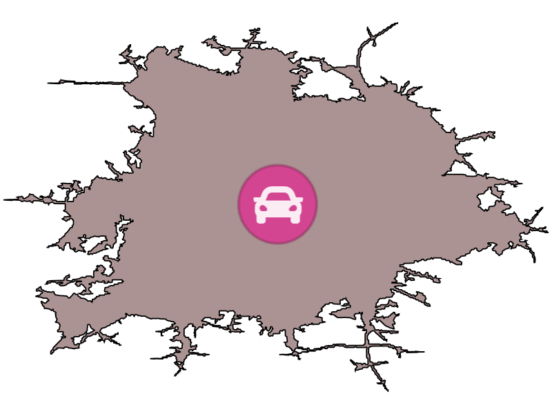
Travel time maps (also called driving time maps or isochrone maps) show how far you can go from a location within a certain time.
In other words, Isochrones are a powerful analytic tool that offer exact answers to the question "what is within X travel time of this location?"
What Travel Time Maps Can Do For Your Business
People search for information online before making a trip, moving home, job hunting or even finding a specific store branch, which means travel time maps are becoming more popular in the business world. When you display travel time alongside search results on a map, it's easier for your customers to compare results. They don't have to click away to look up info on third-party maps. That keeps them on your website.
Using isochrones helps your visitors scout out locations and amenities based on the required travel time. Customizable travel time search means you display the results that matter to your customers, which establishes your business as one they can rely on.
With Geoapify isochrone maps, you can refine the route by your preferred mode of transport. Choose from walking, driving, truck, bicycle, or public transit. For example, find hospitals within twenty driving minutes of a location, or beaches within thirty public transit minutes.
Transportation Modes for Travel Time Maps
Travel time maps support various transportation modes, including driving, walking, cycling, and public transport. This versatility makes them adaptable for different user needs.
Driving: Plan efficient routes with traffic and road network considerations.
Walking: Explore pedestrian-friendly routes with ease and accessibility.
Cycling: Discover bike-friendly paths tailored to safety and regulations.
Public Transport: Integrate transit schedules and networks for precise timing.
This adaptability ensures travel time maps are useful for commuters, tourists, and urban planners alike.
Tourism
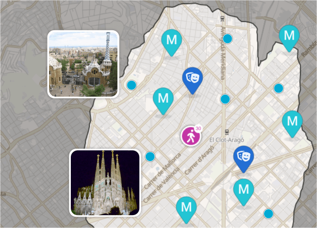
With research showing that 85% of family travelers rank being near major attractions or theme parks as being of utmost importance when booking a holiday, providing a travel time map helps them make decisions.
Time travel maps help tourism businesses provide up-to-date and personalized information to their customers. For example, visitors can see which tourist attractions and amenities are in reach of accommodation so they can make the best choice.
Visitors can also use travel time radius maps to check how close accommodations and amenities are to each other, making it easier to plan day trips and make sure they see all the sights they want.
Estate Agents
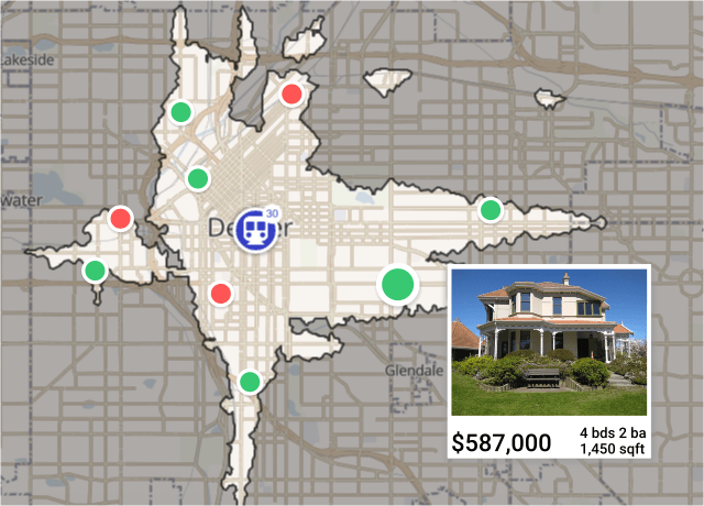
Estate agents can use isochrones to help customers find their next dream home. Having the right things within the right distance is a must when looking for a new home to buy or rent. The time to reach amenities and public transport is important to house hunters. For example, one study found that 25% of people in London said living near a tube is essential when choosing a new home.
Use isochrones to help clients search for schools within a certain walking distance of a property, or shops within a certain driving distance. Customers can also look for sports facilities, swimming pools, other leisure facilities, public transport hubs and more.
Time travel maps make it easier for people to visualize living in a location. They can get a feel for what they'll be able to do in their new location. Using isochrone maps takes the guesswork out of finding properties to view, and encourages customers to book a viewing appointment for houses and apartments that match their needs.
Businesses
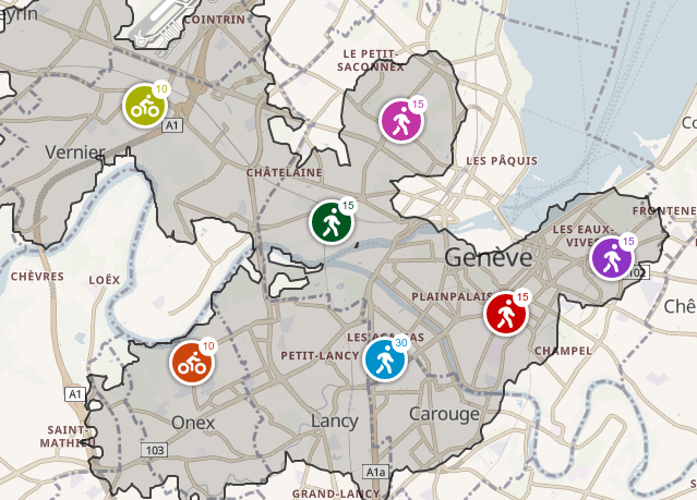
Businesses of all kinds can use isochrones to show customers the travel time from their location to a specific store location. Use travel time maps to create an up-to-date store finder that helps customers find stores near their home, or look at which stores they’ll be able to reach on their next holiday or business trip.
Businesses can use isochrones to expand their company, too. Use isochrone maps to scout out potential new locations, and get a feel for how reachable those locations will be for your target demographic and staff members.
You can combine isochrones with demographic data to better understand potential new areas. For example, find out if your potential clients live or work nearby and how easy it will be for them to reach you within a decent time frame.
Driving Time Maps for Logistics and Delivery
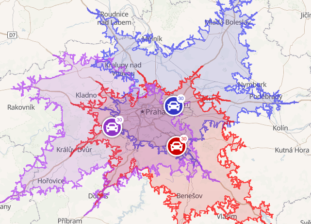
Businesses use travel time maps to find the best locations for their warehouses and logistic centers. These tools focus on places where the travel times from different customers are minimized, thereby reducing costs and handling your sales better.
For example, the size of the isochrone indicates how easily you can reach a place. Moreover, the overlapping of the isochrones shows well-covered areas, while the holes signify where service is problematic.
Commute Planning
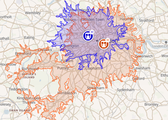
Individuals can use isochrones to plan commuting times for themselves or their families. Optimizing commute times to work or study locations makes for less time spent commuting, and an easier time coordinating with the rest of the family.
Educational institutions and employers can also use commute radius maps to help students or employees plan their commutes and find the most efficient routes. Research shows that every minute of commute time lowers job satisfaction and increases stress, so anything you can do to help students and employees find the best route will help.
Looking for a new office location? Use isochrones to see how good or bad the public transport connections are, and see which amenities such as shops or healthcare locations are in easy reach.
Classifieds and Directories
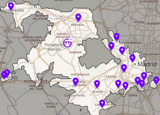
Help classified readers narrow their search to find what matters to them. With driving time maps, they can search for jobs or items for sale within a specific distance of their home. No more finding the ideal job or item for purchase, only to find it’s in a hard-to-reach location or simply too far away.
Narrowing results by travel distance means more relevant and accurate results, and more satisfied customers.
Travel time maps have a wide range of applications across industries and even for personal use. Show your visitors the information they need, and they're more likely to stay on your website, or making a booking of enquiry.
Wondering how best to use isochrones in your business? Eager to get started? Try isochrones for free in our playground, or get in touch to discuss your specific needs.
Travel Time Map tutorials
Check out our tutorials to make it easy to get started and get the results you want with Travel time maps:

How To Make Travel Time Maps For Public Transport - Build Public Transit Isochrones with API
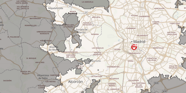
Isochrone Maps: Get Real Reachability Times

Travel time map: TOP 10 use cases for businesses and individuals
Still not sure how to start? If you're facing any problems or have questions, we're here to help! Contact us and we will be happy to assist.
How Much Does It Cost To Build Driving Time Maps?
Geoapify uses a credit-based system for pricing its Isoline API, which powers travel time maps. The number of credits required depends on the isoline range you choose—either in time (isochrone) or distance (isodistance).
- One credit is consumed for every 5 minutes of isochrone or 5 kilometers of isodistance.
To accommodate a variety of users, Geoapify offers a range of pricing plans with increasing credit allocations and additional features. For a detailed overview, visit our Pricing page.
If you're just getting started, our Free Plan includes 3000 credits per day, ideal for experimenting with the Isoline API or running small-scale projects at no cost.
Examples of Credit Usage:
- Example 1: Generating a 30-minute isochrone will consume 6 credits (30 minutes ÷ 5 minutes per credit).
- Example 2: Creating a 50-kilometer isodistance will use 10 credits (50 kilometers ÷ 5 kilometers per credit).
- Example 3: Calculating a 90-minute isochrone requires 18 credits (90 minutes ÷ 5 minutes per credit).
This flexible credit system ensures that travel time maps are accessible for various needs, from simple analyses to complex large-scale projects.
FAQ
What are travel time maps?
Travel time maps, or isochrone maps, display areas that can be reached within a specified travel time from a given location using various modes of transportation, such as driving, walking, cycling, or public transit.
What is the purpose of travel time maps?
Travel time maps help users understand accessibility and reachability within a defined timeframe. They are widely used for urban planning, logistics, tourism, real estate, and more.
What modes of transportation are supported?
Geoapify travel time maps support multiple modes of transportation, including driving, walking, cycling, and public transit.
How does the pricing for travel time maps work?
Geoapify uses a credit-based system. For instance, one credit is used for every 5 minutes of isochrone or 5 kilometers of isodistance. The Free Plan includes 3000 credits daily for small-scale projects.
Can I use travel time maps for free?
Yes, Geoapify provides a Free Plan with up to 3000 credits per day, allowing users to explore the features and capabilities at no cost.
What is the maximum range for travel time maps?
The Isoline API supports ranges up to 60 minutes for isochrones and 60 kilometers for isodistances. Custom solutions are available for larger ranges.
