
Location Intelligence Solutions For Travel & Tourism
Did you know that travelers who book activities ahead of their trip spend 47% more on lodging and 81% more on transportation than those who wait and book at their destination?
Providing high quality information for travelers attracts clients and can boost your revenue. Travel and tourism businesses can use Geoapify mapping software/GIS software, APIs and location intelligence to create solutions for their clients.
How Businesses Can Use Geoapify's API solutions and Mapping Software/Tools for Travel and Tourism
Travel is more than just picking a location and going there. Travelers like to plan in advance so they can book, explore, and enjoy their trip with minimal effort. They want to know where they’re going, what is in reach of their accommodation, and where the nearest amenities are.
Location intelligence helps your company stand out. From the moment travelers click to your website they can find the information they need for their trip, marking you as a helpful, trustworthy business. Travel maps help you make a good first impression before your customers even leave home.
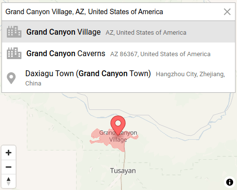
Pick Locations With Geocoding
Planning a trip starts with choosing the place, so address and location search are indispensable for every travel and tourism website. Geoapify offers powerful mapping solutions for travel and tourism that help your customers find their destination.
Geoapify Geocoding converts addresses to latitude and longitude. Site visitors enter an address (exact street address, city, or a country) to find its position on a map. Geoapify also uses reverse geocoding to help people get an address by entering its location. Visitors can click anywhere on the travel map, and it shows them the address of that location.
In addition, Geoapify lets you add autocomplete inputs on your website. When visitors enter part of an address, autocomplete offers address suggestions, for a faster and easier search.
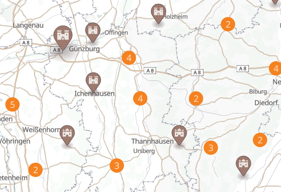
Create And Display Locations On Travel Maps
Use Geoapify Maps to create beautiful interactive travel maps that show customers and app users up to date information. You can use interactive maps to list hotels, show attractions, point out amenities and highlight sites of interest.
Maps make your website more alive, interactive, and interesting. If you also have a tourism app, maps make the app more engaging. Being able to search interactive maps adds valuable functionality. Visitors can find up to date information with just a few clicks.
Maps encourage users to stay on your website and interact with it. Interactive maps encourage visitors to visualize their upcoming trip. They build engagement, and can increase website ratings and your position in search results.
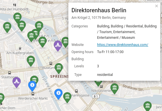
Showcase The Best Places To Visit In A Range Of Categories
Whether they’re traveling for business or pleasure, people want to know what they can do and see when they reach their destination. In the twelve weeks leading up to a trip, people carry out three times more searches for experiences than for hotels.
With Geoapify Places, you can help your customers find exactly what they’re looking for. Geoapify lets users search more than 500 categories of points of interest, including tourist attractions, restaurants, shops, sports facilities, beauty spots, spas, and many more.
Visitors can narrow their search to the criteria that matters most to them. For example, customers can search for only dog-friendly tourist attractions, only vegan or vegetarian restaurants, or self catering accommodation options.
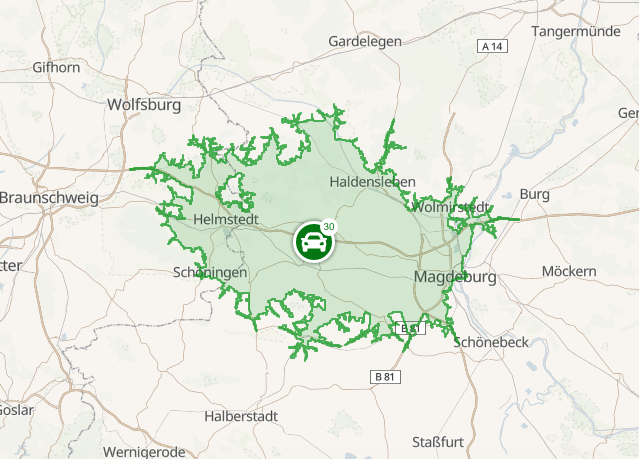
Provide Smart Search By Travel Time
People want to know how easy it will be to reach tourist sites and amenities. Maybe they have a list of must-see sites and they want to know how long it will take to reach them all. Or perhaps they’ve got a tight business schedule and want to know how long it will take to get to their conference from their hotel.
Isolines are becoming more and more popular as mapping tools/solutions for tourism. Innovative travel agencies use them as a tool to help customers understand each location better.
You can use Geoapify Isochrones to show customers what is reachable in a certain time from a location. Users can narrow their search by travel mode, too. They can find out how many theaters are in thirty minutes of driving distance, or how many restaurants are in fifteen minutes of walking distance.
Use Isodistances on your travel maps to show users what they can reach within a certain distance. For example, how many major transport hubs are within twenty miles, or how many beaches are within five.
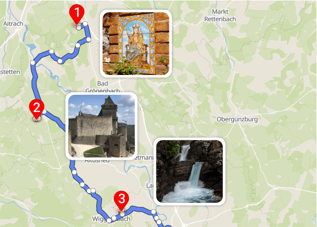
Build Routes And Provide Directions
With Geoapify Routing you can show your customers the optimal route for where they want to go. Let them know the best walking route between their hotel and nearby attractions, or the best driving route from their home to the hotel.
Geoapify Route Planner offers tourism solutions for businesses. Tourist industries such as food delivery drivers or guided tours can plan the most efficient routes for their staff. Take into account factors such as the number of vehicles, driver capacity, and lunch breaks.
Routing and Route Planner support many travel modes. Some of the most popular for the travel and tourism industry include walking, hiking, biking (including citybike, racer bikes and mountain bikes), driving, and public transportation. Need a customer transportation mode for your maps? We can help with that too.
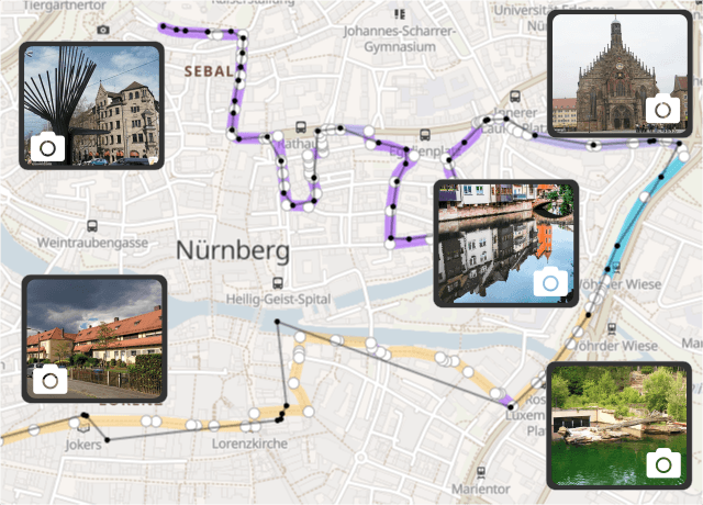
Recreate A Route From GPS Coordinates
Imagine you have a list of GPS coordinates from a GPS tracker or just a smartphone. Geoapify’s Map Matching function lets you recreate the initial route from the provided location points.
Customers can enter their GPS coordinates to get a clear route visualization. They can save their routes, experiences, and impressions. Route reconstructions also include information about the road type, surfaces and restrictions, and even instances of dangerous driving.
Travel and tourism businesses can use map matching for position live tracking. Use the calculated route to see if the customer’s current position is still on the route, and to see if they took a wrong turn.
With 74% of travelers saying they will spend more time choosing a destination this year, and 70% spending more time finding things to do, providing high quality information to your customers has never been more important. Geoapify GIS Software helps you create travel solutions that give your customers what they’re looking for, quickly and easily.
How Much Does Mapping Tools/GIS Software for Tourism Cost?
With Geoapify, you can create scalable, personalized mapping applications by choosing the APIs that best suit your business requirements. Whether you need maps for travel planning, routing, geocoding, or location intelligence for hospitality operations, we offer our APIs at a highly competitive and flexible price point, making them accessible for businesses of any size.
To simplify the pricing calculation process, we use a credit system. Each API has different levels of complexity and cost, so credits make it easier to estimate pricing for your application based on the specific features you need.
Example of Pricing Calculation Using Credits
Let’s consider an example of an interactive map application for a tourism business. The app includes place search functionality, address input, and the ability to display reachability maps (also known as isolines).
Here’s a breakdown of the credit usage per user session based on typical usage statistics:
| API | Usage per Session | Credit Cost per Request | Total Credits |
|---|---|---|---|
| Map Tiles | 50 requests | 0.25 credits per request | 50 * 0.25 = 12.5 |
| Places API | 15 requests | 1 credit per request | 15 * 1 = 15 |
| Autocomplete API | 12 requests | 1 credit per request | 12 * 1 = 12 |
| Isoline API | 2 requests (30 min isoline) | 6 credits per request | 2 * 6 = 12 |
| Total Credits per Session | 51.5 credits |
Example Credit Usage and Corresponding Pricing Plans
Here’s an expanded table that includes the estimated daily credit consumption for different usage levels and suggests the corresponding pricing plan to cover the required credit volume.
| Usage Level | User Sessions/Day | Total Credits/Day | Suggested Pricing Plan |
|---|---|---|---|
| Starter Scale Usage | 50 | 2,575 | FREE (Up to 3,000 credits/day) |
| Small Scale Usage | 1,000 | 51,500 | API 50 (Up to 50,000 credits/day) |
| Growth Scale Usage | 5,000 | 257,500 | API250 (Up to 250,000 credits/day) |
| Enterprise Scale Usage | 10,000 | 515,000 | Custom Plan (Flexible, based on requirements) |
To explore our complete pricing details and find the right plan for your needs, visit our Pricing Page.
Use our price calculator to estimate the exact cost for your desired usage level and plan.
Start using Geoapify Travel APIs for Free, and then upgrade when you need it. Start today and create your first map in just minutes.
FAQ
What travel and tourism solutions does Geoapify offer?
Geoapify provides interactive Maps, Geocoding, Places search, Routing, and Isochrone APIs to create engaging travel and tourism applications. These tools help display points of interest, optimize routes, plan itineraries, and enhance the overall travel experience.
How can Geoapify benefit tourism businesses?
Geoapify’s solutions enable businesses to showcase attractions, provide detailed maps, offer route planning, and display reachability information. These features help improve customer engagement and streamline trip planning for travelers.
Can Geoapify show travel times and distances?
Yes, Geoapify’s Isochrones API allows you to display reachable areas based on travel time or distance for different transportation modes such as walking, biking, or driving. It’s ideal for visualizing catchment areas and providing detailed accessibility data.
How does Geoapify ensure data accuracy for tourism applications?
Geoapify uses high-quality data from sources such as OpenStreetMap and other verified providers, ensuring accurate location information, up-to-date points of interest, and reliable routing options for tourism-related applications.
Can I use Geoapify to display tourist attractions and amenities?
Yes, Geoapify’s Places API allows you to search and display various points of interest, including restaurants, hotels, tourist sites, and amenities, making it easy to build informative travel and tourism maps.
What pricing plans does Geoapify offer for tourism businesses?
Geoapify offers flexible, credits-based pricing plans that cater to different business sizes, from small agencies to large enterprises. For more information, visit our Pricing Page to explore available options.
How can I get started with Geoapify for tourism applications?
Getting started is easy! You can sign up for a free account on our website, explore the APIs, and access detailed documentation to start building your tourism solution right away.

Questions about our travel and tourism mapping solutions?
Reach out to our team, and we’ll be happy to help!